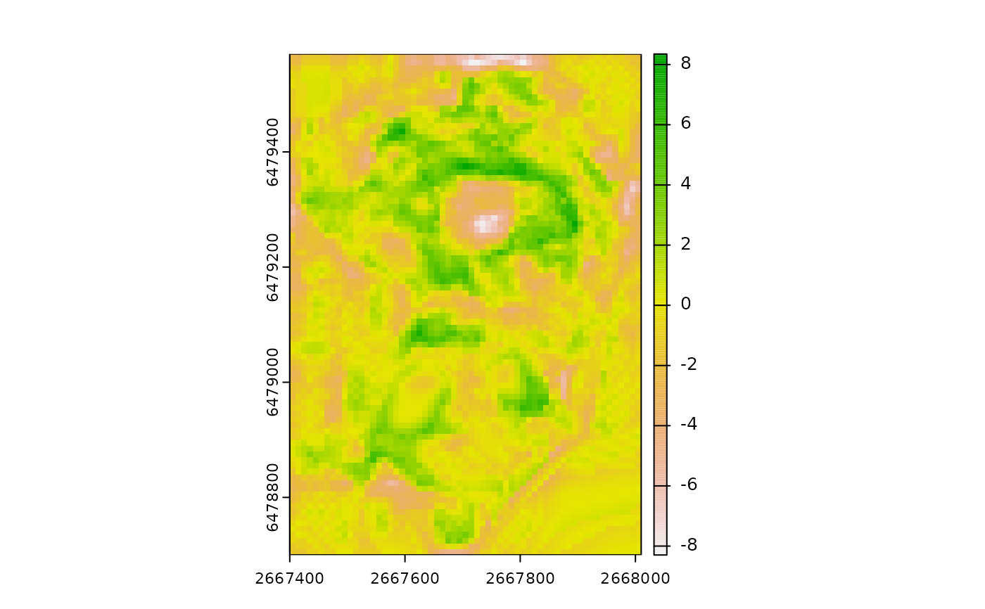
Calculates Bathymetric Position Index (BPI). BPI is a measure of relative position that calculates the difference between the value of the focal cell and the mean of cells contained within an annulus shaped neighborhood. Positive values indicate local highs (i.e. peaks) and negative values indicate local lows (i.e. depressions). BPI can be expressed in units of the input DTM raster or can standardized relative to the local topography by dividing by the standard deviation or range of included elevation values in the focal window. BPI calls the function RelPos internally which serves as a general purpose and more flexible function for calculating relative position.
Usage
BPI(
  r,
  w,
  stand = "none",
  unit = "cell",
  na.rm = FALSE,
  include_scale = FALSE,
  filename = NULL,
  overwrite = FALSE,
  wopt = list()
)
Arguments
- r
r DTM as a SpatRaster or RasterLayer.
- w
Vector of length 2 specifying c(inner, outer) radii of the annulus in "cell" or "map" units or a focal weights matrix created by MultiscaleDTM::annulus_window. Inner radius must be less than or equal to outer radius. There is no default size.
- stand
Standardization method. Either "none" (the default), "range" or "sd" indicating whether the relative position should be standardized by dividing by the standard deviation or range of included values in the focal window. If stand is 'none' the layer name will be "bpi", otherwise it will be "sbpi" to indicate that the layer has been standardized.
- unit
Unit for w if it is a vector (default is unit="cell"). If w is a matrix, unit is ignored and extracted directly from w.
- na.rm
Logical indicating whether or not to remove NA values before calculations.
- include_scale
Logical indicating whether to append window size to the layer names (default = FALSE) or a character vector specifying the name you would like to append or a number specifying the number of significant digits. If include_scale = TRUE the appended scale will be the inner and outer radius. If unit="map" then window size will have "MU" after the number indicating that the number represents the scale in map units (note units can be extracted from w created with MultiscaleDTM::circle_window and MultiscaleDTM::annulus_window).
- filename
Character output filename.
- overwrite
Logical. If TRUE, filename is overwritten (default is FALSE).
- wopt
List with named options for writing files as in writeRaster.